

Why Go?
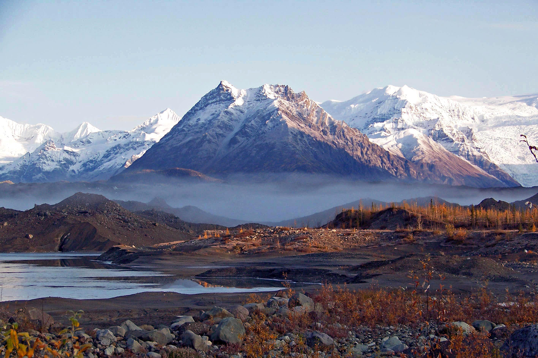
Most people think of Denali when considering a trip to Alaska. I was all geared up to go see the tallest mountain on the continent until I started researching the area and learned more about Wrangell-St. Elias National Park. Wrangell is the largest national park in the states covering 13,175,799 acres (that’s six times the size of Yellowstone!), with very few trails to navigate. Efforts have been made to preserve the rugged, natural landscape devoid of man-made trails and campgrounds. There is very little hand holding done by park rangers as well. Wrangell does not require permits and pretty much lets you go wherever. What results is a park preserve that seems utterly untouched and if you plan it right you won’t see another soul for days. Assuming you are into that kind of thing.

Getting there:
Wrangell-St. Elias National Park is located about 8 hours by car east of Anchorage. Most people access the park by air taxi out of McCarthy, Alaska. Renting a car in Anchorage can be an issue if you wait until the last minute so plan ahead and make sure to let the rental company know that you are going to McCarthy. There is about 30 miles of dirt road to get there and most rental car companies won’t allow sedans on the road. Call Levi’s car rental in Anchorage for fair prices. The drive along Highway 1 to McCarthy is worth the trip itself. Give yourself some time to enjoy it. Tyson (hiking buddy) and I flew from McCarthy into the park with Wrangell Mountain Air (highly recommended). They ultimately talked us into doing the Seven Pass route and I’m glad they did. They dropped us off at Iceberg Lake and six days later they picked us up at the Bremner mine without a hitch. I asked them what happens if we aren’t at the extraction point at the scheduled time and they said, “that’s when it starts getting expensive for you”. I guess search and rescue isn’t free??

The Seven Pass Route:
The good news about this hike is you actually only tackle three mountain passes. After the 3rd you are happy as hell you don’t have four more. I recommend starting at Iceberg Lake and ending at the Bremner mine as opposed to the other way around (it can be done either way). The lake is actually formed by glacial calving that dams glacial rivers in the area preventing meltwater from escaping into the Tana River. Without a trail you rely on route finding to traverse crevassess and moulins of two glaciers including the Tana Lobe of the Bremner glacier, ford multiple streams and rivers, bushwhack through some truly heinous brush, navigate over massive boulder fields of loose rock, and camp near multiple mountainous, glacial lakes. Some experience (but not much) is necessary with backcountry navigation. You should at least be comfortable with GPS and have some map and compass skills. You will be encouraged to go out with a guide but it’s not necessary. A little experience and some common sense go a long way.
Day 1 - Iceberg Lake to Bering Glacier:
After getting out of the sandy beach bottom of the receding Iceberg Lake, we followed the river to the first glacier crossing, the Bering Glacier. We threw on crampons and tried to not fall in a crevasse.


Glaciers are gnarly. They tear up a lot of mountain creating moraines which ultimately means a lot of loose boulder sitting on ice to fall on, especially when carrying a 40 pound pack. Trekking poles were no longer a luxury item as they are with trail hiking, they were essential.
Day 2 - Over the 1st pass:
Following the river bottom is easy hiking compared moraine hiking (especially in late June which was not too marshy). This ease quickly ended when we needed to gain elevation to traverse the 1st mountain pass. Lack of a trail and our first introduction to mild bushwhacking made for a challenging pass. If only we knew just how bad the bushwhack was going to get.


Day 3 - The Bremner Glacier:
After a nice night on the spongy grasses near the mountain lakes in the saddle of the first pass, we made our way towards the Tana Lobe of the Bremner Glacier. Glaciers change considerably year to year so finding a spot to access the glacier can be challenging. What used to be an easy gradual incline that hikers accessed a few years ago could now be a 40 foot vertical wall of ice. We made for a vantage point above the glacier to plan our route, trying to determine how best to avoid crevasses as well. We failed at the latter.


The crevasse labyrinth was time consuming, and even though it didn’t get dark until about midnight up there in late July we knew there was no good camping until after the next pass, which would require several hours of work. So we made camp on the ice.

The fog set in the next morning.

Day 4 - 2nd pass through the brush
As we we made our way over the 2nd mountain pass of the route we discovered the joy of Alaskan backcountry bushwhacking. It can get thick, tall, and mean.

We literally spent hours in this stuff.

When I asked a local expert why it is recommended to plan on at least 6.5 days of hiking to go only 40 miles, I was told “the mileage is irrelevant”. Boulder fields, river crossings, and truly heinous bushwhacking slow you down considerably. It’s impossible to not lose one’s mind a bit after multiple hours in this brush.

Finally we gained enough elevation to get out of the vegetation to set up camp. The rocks were a sight for sore eyes.
Day 5 - Overshooting our exit
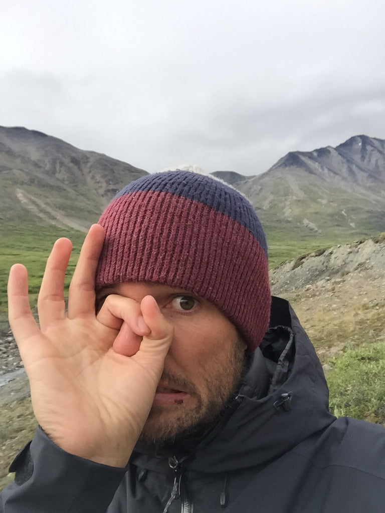
Day 5 was supposed to be mellow. We crossed Monohan creek without much difficulty (even though Alaskan creeks are raging rivers in the lower 48). We had little elevation to gain until the 3rd and final pass that we weren’t planning on traversing until day 6 anyway. Then we hit the brush again. We put our heads down and powered through another bushwhack. Bushmaster Tyson got ahead of me some, (I guess he’s skinny enough to fit through anything), and after a couple of hours something felt wrong. I stopped to look at the GPS and noticed we passed the 3rd saddle about a mile back. Now, a mile back on a trail isn’t much. A mile back through the brush is PAINFUL. I was yelling for Tyson at this point and trying to catch up to him by wading down the creek. When we met up we set up camp defeated. Not our finest hour.

This is me pissed off in Alaska.
Day 6 - 3rd and final pass
We backtracked through some brush and after some time arrived at the approach of the 3rd saddle. It was pretty brutal; steep and rocky. By far the most physically challenging section of the hike, it took some doing. Not half as psychologically challenging, however, as getting beat up by the bush all day.

Over the pass we were greeted with blue glacial lakes. Cold as hell but we jumped in anyway after a tough climb.

Day 7 - Last few miles to the Bremner mine
The Bremner mining district was active in the early 1900’s. Today there are still artifacts from that time. The air strip was a welcome sight.


I was happy that I had remembered correctly about the date and time of the pick up. Tyson was excited about a toilet
If you’ve ever daydreamed of seeing Alaska, skip the cruise and spend some time in Wrangell.
Author: Mike Francis
Follow Mike on Instagram @mikejfrancis